This article was first published on iklimriskleri.com and migrated with a July 2026 update.
One of the most tangible physical risks of climate change is the increasing frequency and intensity of flood events. Türkiye has experienced this firsthand over the past two years: in September 2025, rainfall reaching 276 kilograms per square meter hit the Rize-Artvin corridor, and in May 2026, floods and landslides in Hatay claimed 4 lives. In this article, we summarize the types of floods, how climate change amplifies flood risk, and the role of data-driven risk analysis.
Flood Types and Their Impacts
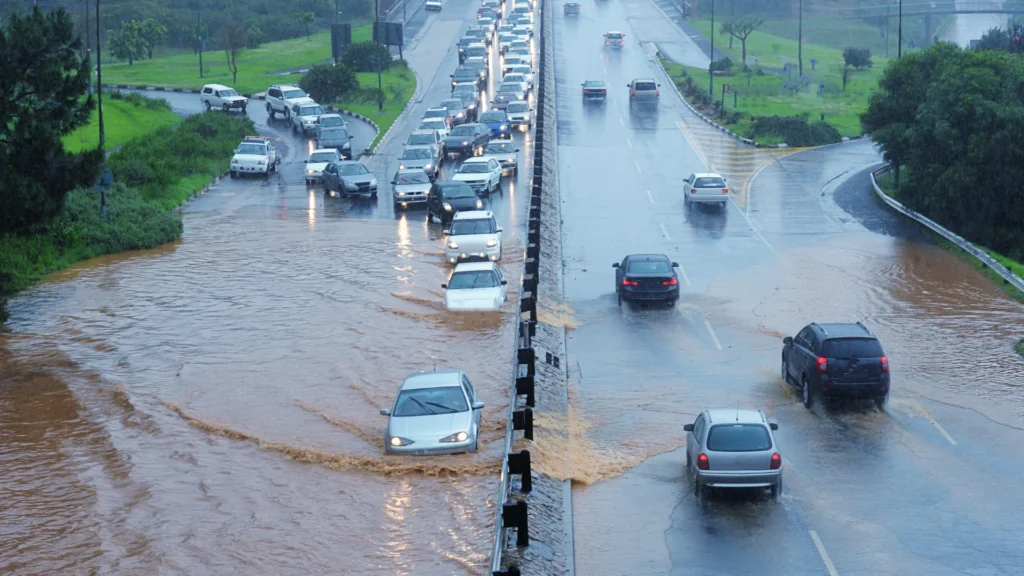
Each flood type has its own formation dynamics and damage profile; the right precaution starts with the right classification:
| Type | Trigger | Typical impact | Where it occurs |
|---|---|---|---|
| Flash flood | Extreme rainfall in under 6 hours; dam or levee failure | Sudden rise in water level with very little warning time; the type with the highest risk to life | Narrow valleys, urban stream beds |
| River (fluvial) flood | River channel capacity exceeded by prolonged or intense rainfall | Widespread inundation that can last for days; economic losses | Farmland, riverside settlements |
| Coastal flood | Sudden rise in sea level driven by storm winds and low pressure | Damage to ports and coastal roads; erosion, saltwater intrusion | Coastal cities, delta regions |
| Pluvial (surface) flood | Intense rainfall exceeding drainage capacity, with no river or sea overflow | Flooded underpasses, basements and streets; transport disruption | Densely paved urban centers |
How Does Climate Change Amplify Flood Risk?
For every 1°C of warming, the atmosphere can hold roughly 7% more water vapor, which means far heavier downpours under the right conditions. Indeed, the IPCC Sixth Assessment Report shows that the frequency and intensity of extreme precipitation are increasing on a global scale; short, intense downpours have been scientifically shown to occur more often than in the past, raising flash flood risk.
The second mechanism is sea level rise: on top of the roughly 20 cm increase since the early 20th century, the rate of rise reached 3.7 mm per year over 2006-2018, nearly three times the 20th-century average. A higher base level triggers flooding even in smaller storms; once-rare high-tide floods are becoming routine in many coastal cities. According to IPCC projections, an additional rise of 30 cm to 1 m is likely by 2100; scenarios approaching 2 meters remain on the table if ice sheets destabilize. Coastal floods regarded today as “once in 100 years” events could occur every few years under these conditions.
What Do the Numbers Say?
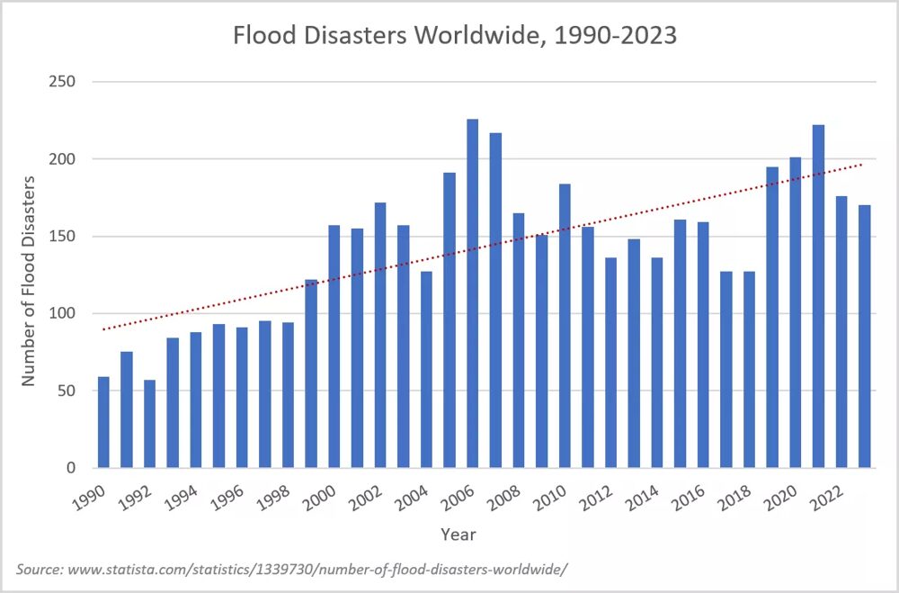
Floods have become the world’s most frequent natural disaster in recent years: more than 4,800 flood disasters were recorded between 1990 and 2023. The 223 floods in 2021 alone were 36% above the average of the previous 20 years (~163). In Türkiye, according to records from MGM, the Turkish State Meteorological Service, 2,486 severe rainfall and flood events were reported between 2010 and 2021, close to storms (2,645 events), the most frequent meteorological disaster. More than 300 floods occurred nationwide in both 2018 and 2019; the count exceeded 200 in every year from 2018 through 2021, and in 2020 severe rainfall and floods held the largest share of meteorological disasters.
Two Cases from the Field: Rize-Artvin 2025 and Hatay 2026
On September 19-21, 2025, rainfall of up to 276 kilograms per square meter was recorded in Rize and Artvin; a bridge collapsed and the road to Ayder Plateau was cut off. No lives were lost, but the event showed once again how infrastructure in narrow, steep valleys can be knocked out within hours. In Hatay on May 20-22, 2026, the Asi River overflowed and the Karaçay Bridge partially collapsed; the toll was 4 lives lost and 17 injured. Beyond public budgets, these losses directly affect the insurance and reinsurance sector; the need for location-based risk intelligence to price assets in flood zones correctly grows every year.
Data-Driven Risk Analysis with UrClimate Next
UrClimate Next processes fully validated climate projection data behind the scenes, letting engineers and sustainability professionals assess flood risk for a specific location or facility at a single click, through clear, readable scores. Its reliability has been field-tested: the locations of 45 flood events that occurred in Türkiye between 2014 and 2024 were reviewed, and the areas the platform scored as high risk largely overlapped with where floods actually happened. Built on the same infrastructure, UrClimate Score rates physical risks including floods at the location level, making portfolio-wide comparison easier.
From Rize to Hatay, the events of the past two years show that flood risk is not a distant projection but today’s reality. Data-driven risk analysis is becoming both faster and more scientifically robust, enabling greater resilience everywhere from infrastructure projects and urban planning to insurance and disaster management.